
Bio
Dustin is a software engineer working to make transportation planning tools more widely accessible. He originally gained an interest in agent-based modelling and simulation from a background in creating computer games. He graduated from the undergraduate Computer Science program at the University of Texas at Austin. There he built a traffic simulation that allows a fleet of autonomous vehicles to participate in auctions to move through intersections more quickly. He then joined Google Cloud in Seattle, where he worked on backend systems for Google Compute Engine. In 2018, he started A/B Street, an open-source project to let interested citizens explore and propose changes to road networks to improve walking, cycling, and public transit. He joined the Urban Analytics team at The Alan Turing Institute in December 2021.
Projects
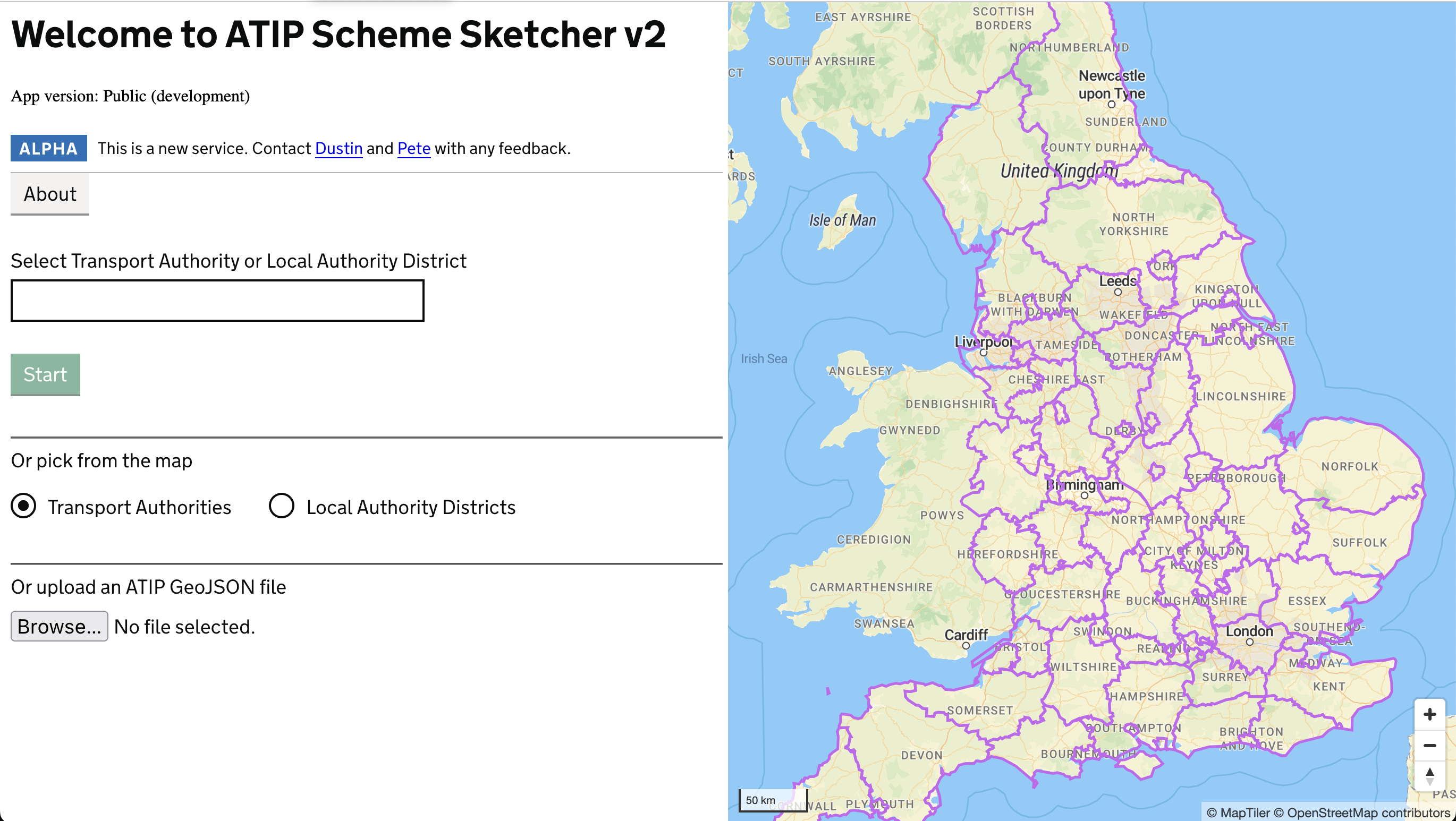
ATIP
An online tool to design, modify and share active travel infrastructure plans as part of ATE's offering
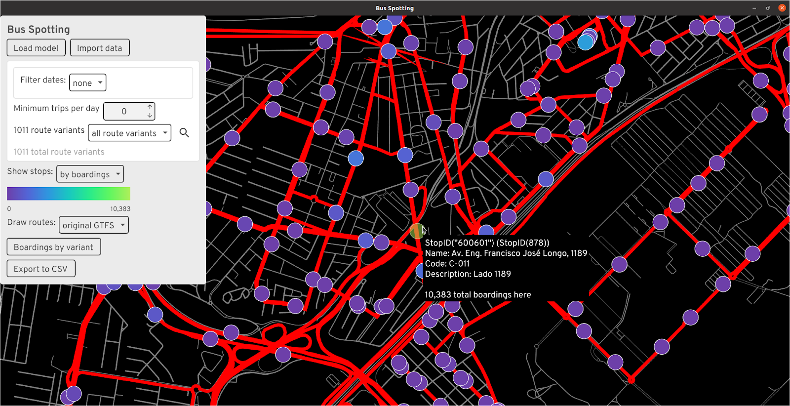
Bus Spotting
View GTFS public transit data and compare real-time bus data to idealized schedules
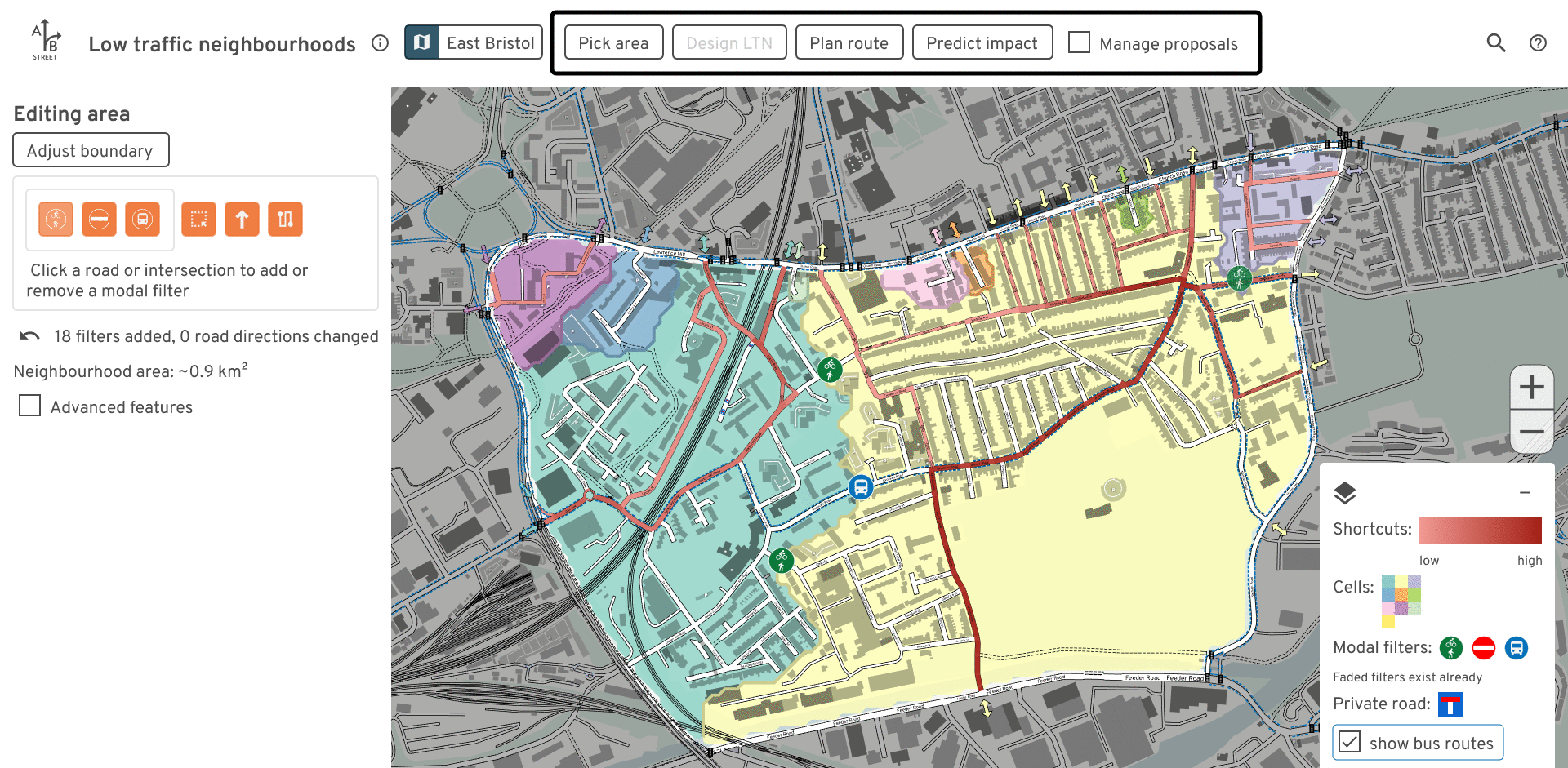
Low Traffic Neighbourhoods tool (LTN)
A software tool and web app to study and communicate about design and impact of LTNs. Dev
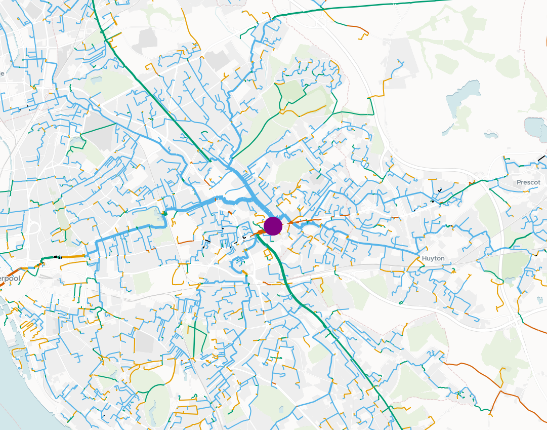
od2net
Tool to rapidly generate route networks in different formats

odjitter
Disaggregate zone-based origin/destination data to specific points for building travel-demand models
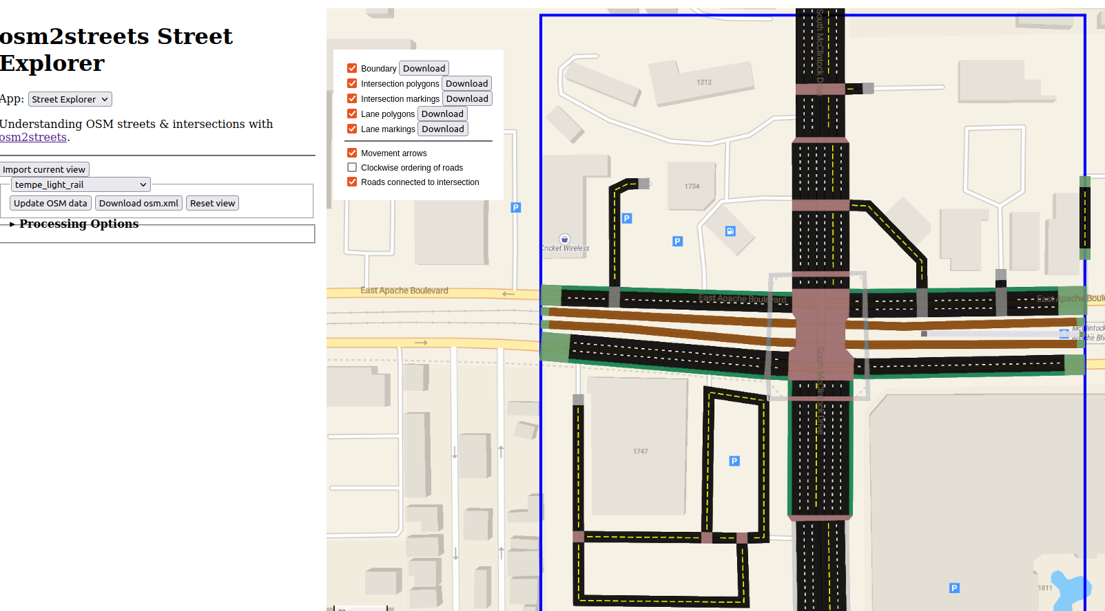
osm2streets
Transform OpenStreetMap data to street networks with detailed geometry and semantics
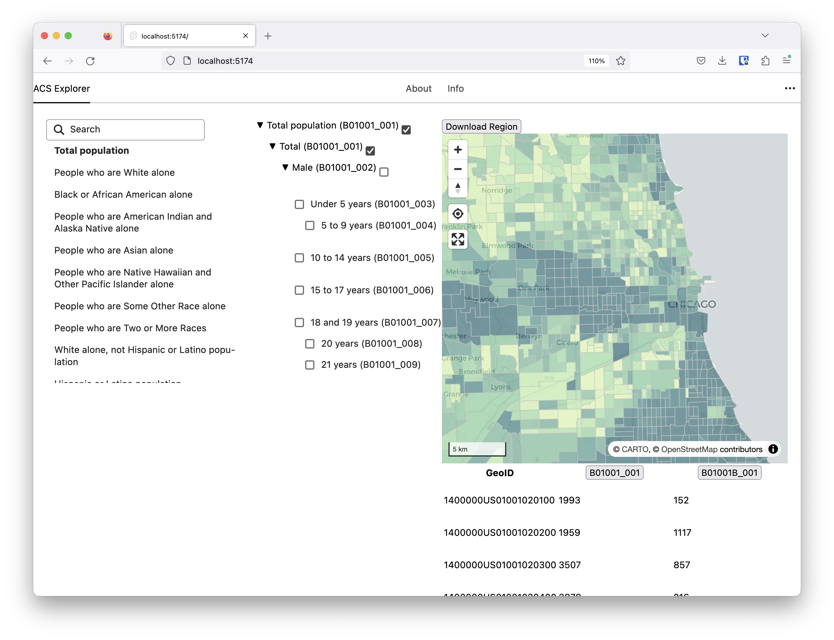
Popgetter
Get all the census you need or want using popgetter

Route Snapper
Draw routes in MapLibre snapped to a street network using client-side routing

Synthetic Population Catalyst
Tool that creates a synthetic population for any area within Great Britain, including socio-demographic, health and daily activity data. Calibrated to 2020, with projections of some variables to between 2012 and 2039.