DemoLand
Spatial modelling for land management predicting the impact of large-scale planning and land use changes on the quality of life.
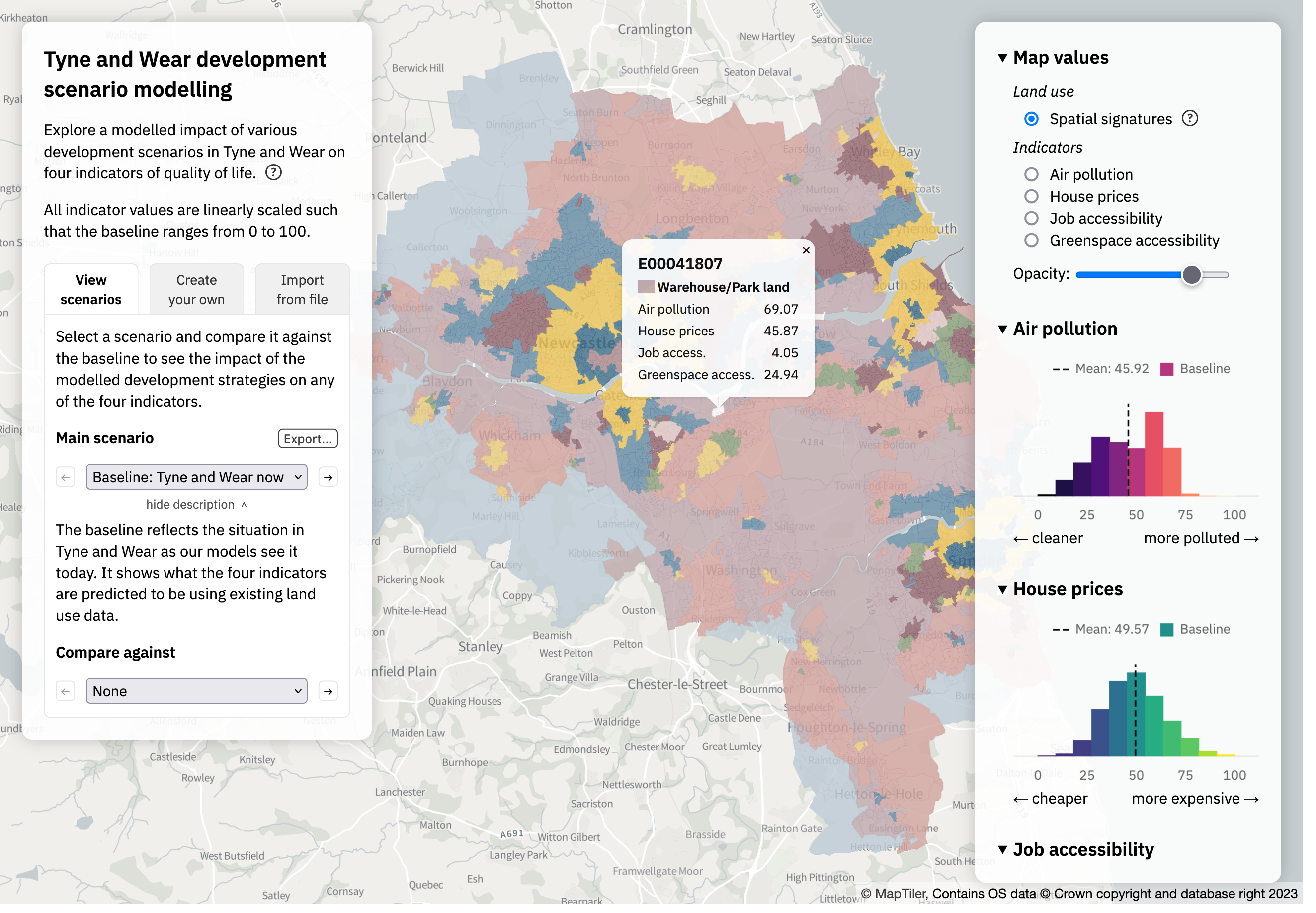
This interactive app showcases the outcomes of the Land Use Demonstrator project, which seeks to develop a modelling system leveraging data science and AI to support decision-making in land use policy.
In this project, competing aspects of land use in an urban environment are identified and quantified. We first do this for present-day Tyne and Wear (called the baseline), and then create specific scenarios where the distribution of land use is modified. These land use characteristics are then used to calculate four indicators which represent different aspects of quality of life.
The project is led by the Geospatial Commission and The Alan Turing Institute, working in conjunction with Newcastle City Council. You can read more about the project in the associated Land Use Demonstrator book.